Active Transport Footpaths
Overview
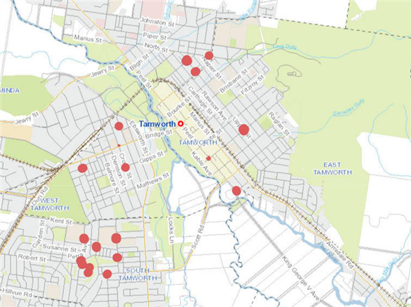
Tamworth’s Active Transport Strategy, a key part of the Tamworth Integrated Transport Masterplan within Blueprint 100, aims to make it easier for more local residents to walk or cycle around the city. New footpaths and pram ramps are being constructed at a range of locations across Tamworth to make it easier for residents to walk or cycle. The locations for the paths have been identified to enable residents to walk or cycle between schools or other community facilities.
Funding
The project was made possible by the NSW Government’s “Get NSW Active” program. Funding for the footpaths totals $1,318,250.
Footpath locations
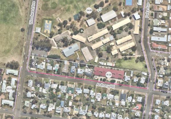
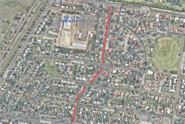
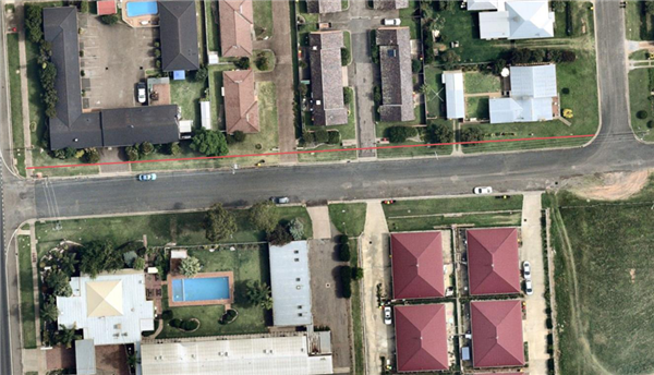
Anthony Road, South Tamworth
A 1.5m wide footpath will be constructed on the north side of Anthony Road, between Woodward Avenue and Petra Avenue.
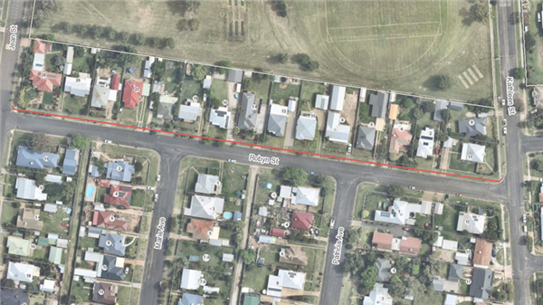
Robyn Street, South Tamworth
A 1.5m wide footpath will be constructed on the north side of Robyn Street, between Jean Street and Kathleen Street.
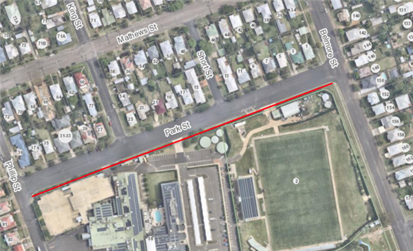
Park Street, West Tamworth
A 1.5m wide footpath will be constructed on the south side of Park Street, between Belmore Street and Phillip Street.
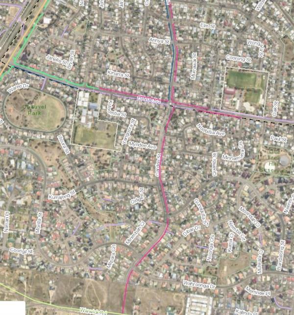
Garden Street (North), South Tamworth
A 1.5m wide footpath will be constructed on both sides of Garden Street, between Robert Street and Kent Street.
Garden Street (South), Hillvue
A 1.5m wide footpath will be constructed on the west side of Garden Street commencing at Hillvue Road and travelling south, terminating at the end of the street.
Murray Street (East), Tamworth
A 1.5m wide footpath will be constructed on the east side of Murray Street, between Peel Street and Marius Street.
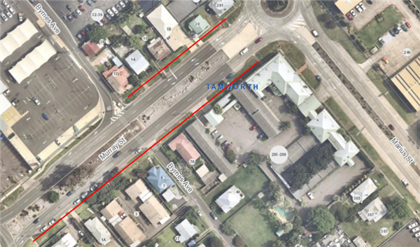
Murray Street (West), Tamworth
A 1.5m wide footpath will be constructed on the west side of Murray Street between Byrnes Avenue and Marius Street.
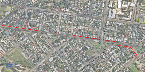
North Street, North Tamworth
A 1.5m wide footpath will be constructed on the north side of North Street between Bligh Street and Bourke Street. The path will cross through the park and then move to the South side of the street between Darling Street and Bourke Street.
Thibault Street, South Tamworth
A 2.5m wide shared path for pedestrians and cyclists will be constructed on the south side of Thibault Street between the Levee exit and Goonoo Goonoo Road.
Pram and kerb ramp construction
A number of kerb and pram ramps will be constructed at various locations across North Tamworth, East Tamworth, South Tamworth, West Tamworth and Oxley Vale.